Warning of downpours and hail as wettest start to year on record continues

Forecasters are warning of heavy showers and storms in the south-east of the country later on Wednesday as the wet start to the year continues.
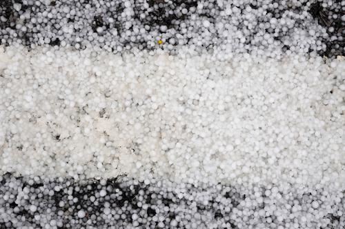
The meteorological service KNMI has issued a code yellow warning for the provinces of Noord-Brabant, Limburg and Gelderland as heavy rain is expected to sweep in from the south from 2pm.
Some areas could see hailstorms and localised flooding, the KNMI warned. Other parts of the country are expected to be predominantly dry, with temperatures of between 14C on the coast to 17C in the south.
More rain is expected on Thursday morning, but better weather is forecast for the weekend, with longer sunny spells, a light north-easterly wind and temperatures of between 18C and 21C.
2023 has been the wettest year on record so far, with 372mm of rain falling at the central weather station in De Bilt, Utrecht, up to and including May 9.
The heavy rainfall and low sunshine have dampened the prospect of extreme temperatures this summer. So far this year the thermometer at De Bilt has passed the 20C mark on just four days.
Nicolien Kroon of Buienradar said there was no chance of the drought-like conditions of recent years recurring in 2023.
‘For the last three years it’s been bone dry heading into summer. This year the water levels have been filled well,’ she told RTL Nieuws.
‘That’s good news: hopefully we won’t have to sprinkle so much and more moisture will evaporate, which will mean it won’t be quite as hot.’
Thank you for donating to DutchNews.nl.
We could not provide the Dutch News service, and keep it free of charge, without the generous support of our readers. Your donations allow us to report on issues you tell us matter, and provide you with a summary of the most important Dutch news each day.
Make a donation