1 Schokland
Schokland was a peninsula that by the 15th century had become an island which kept getting flooded. In the end the authorities were so exasperated by the islanders, who insisted on returning to their swampy home, that they were ordered to destroy all their housing and move to the mainland permanently.
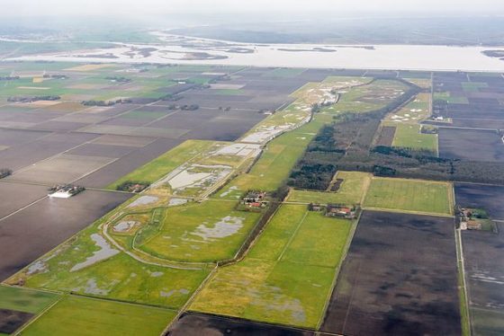
Since the 1940s the island has been part of reclaimed land and old houses and other buildings have been placed there to recreate what it was like. It is odd to gaze out over farmland and think it was once the sea bed.
2 Stelling van Amsterdam
Living in a swamp and want to keep out your enemies? The Stelling van Amsterdam is a 135 km defence line around the Dutch capital based on controlling the water. Built between 1883 and 1920, the defence line is a network of 46 armed forts linked by a complicated network of reclaimed land (polders) and canals.
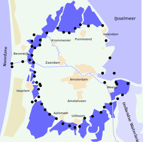
Think of it like a giant moat – at the first sign of trouble, flip the switches and Amsterdam is surrounded by water. Although the introduction of airplanes made this defence line redundant, much of it remains intact with the forts open for tourists, or utilised by various small businesses
3 Historic inner city and harbour of Willemstad, Curacao
Tropical beaches, sunshine, cocktails at sundown. It’s the only one of the 10 we have not visited and we want to go. Following Spanish occupation, the Dutch took possession of the Caribbean island of Curacao in 1634, establishing the Dutch West Indies Company to manage export and trade movements between the islands and Europe.
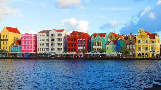
The decision to include the historic area of Willemstad in the Dutch list appears to be based on the cultural influence the Dutch had on local town planning, architecture, trade relations and multicultural relationships in Curacao. Curacao remained a Dutch colony until 1955, when it gained independence and self-government within the Kingdom of the Netherlands.
4 Kinderdijk-Elshout mill network
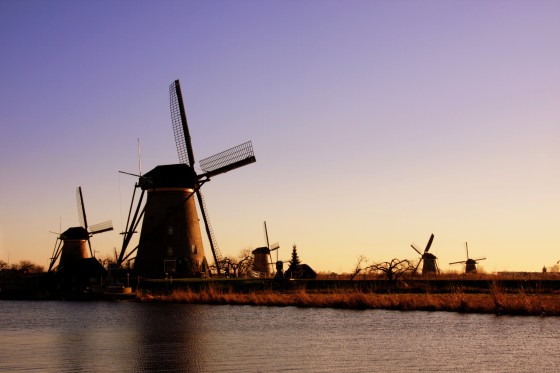
The Netherlands has been fighting against the swamp since the Middle Ages and the Kinderdijk mill complex illustrates this perfectly: dykes, reservoirs, pumping stations, administrative buildings and a series of beautifully preserved windmills dating from 1740 when the land was first drained. Kinderdijk is a small village in the province of South Holland, approximately 15 kilometres from Rotterdam and a very popular tourist attraction.
5 Ir.D.F. Woudagemaal
Perhaps not the most romantic name in the world, but if you like your engineering, you’ll like this. Engineer D F Wouda’s steam pumping station was opened in 1920 and remains the biggest ever built. It is still in use today on occasion.
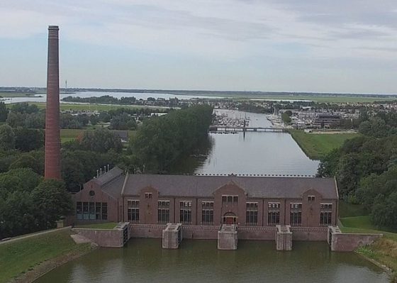
You can tell things are getting serious with the water levels if a television news reader states that the D F Wouda mill has been started up.
6 Droogmakerij de Beemster
Yet another polder that has been granted World Heritage listing is the Beemster Polder in the province of Noord Holland. Historians describe the creation of the Beemster Polder as the impetus for town planning based on Renaissance ideals – or more simply, this means that laws dating back to 1616 dictated the size of allotments, the plan for roads, and the conditions about the planting of trees along roadways.
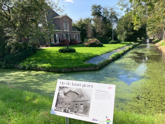
The drainage of water from inland lakes and ponds was controlled by windmills and dykes until the 1800s when the system converted to steam power. Today, this process is conducted by electric pumping stations.
7 Rietveld Schröder house
Built in 1924, this former family house in Utrecht is a modern architecture icon. The architect, Gerrit Rietveld (1888-1964), designed the house based on the principles of De Stijl – a Dutch collective of artists and architects devoted to the ideals of Modern neo-Plasticism or ‘total abstraction’.
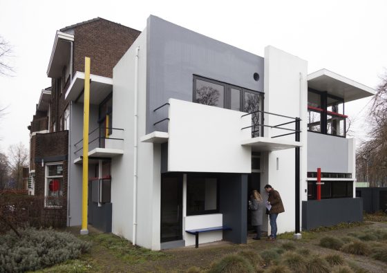
Simply, designs were based on non-intersecting horizontal and vertical lines and layers, and colour usage was restricted to red, black, blue, yellow, white and grey. The house was built for Truus Schröder-Schräder, who lived in it until she died in 1985, first with her children, and then with Rietveld, following the death of his wife.
8 The Wadden Sea (shared with Germany)
The Wadden Sea is an area of islands, sea and mud flats stretching from Den Helder north of Amsterdam to Denmark and is famous for its biodiversity.
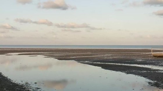
The inclusion of the Wadden Sea in the World Heritage list is attributed to the fact that it remains a largely untouched large-scale, intertidal ecosystem supporting over 4000 fauna and flora species in their natural habitats. Plus, of course, the tens of thousands of holidaymakers who flock there.
9 Amsterdam’s 17th century canal rings inside the Singelgracht
Added to the list in 2010, the city’s canal rings were built to drain the marshes and to create new land for housing, in what was considered the first large-scale example of town planning.
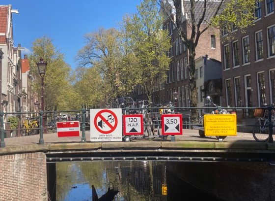
Work started in 1613 and as anyone who has taken the easy route of exploring Amsterdam via a canal boat tour can attest, the urban planners knew what they were doing.


